pygmt.grdlandmask
- pygmt.grdlandmask(*, area_thresh=None, resolution=None, bordervalues=None, outgrid=None, spacing=None, maskvalues=None, region=None, verbose=None, registration=None, **kwargs)[source]
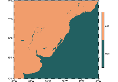
Create a grid file with set values for land and water.
Read the selected shoreline database and create a grid to specify which nodes in the specified grid are over land or over water. The nodes defined by the selected region and lattice spacing will be set according to one of two criteria: (1) land vs water, or (2) the more detailed (hierarchical) ocean vs land vs lake vs island vs pond.
Full option list at https://docs.generic-mapping-tools.org/latest/grdlandmask.html
Aliases:
A = area_thresh
D = resolution
E = bordervalues
G = outgrid
I = spacing
N = maskvalues
R = region
V = verbose
r = registration
- Parameters
outgrid (str or None) – The name of the output netCDF file with extension .nc to store the grid in.
spacing (str) –
xinc[+e|n][/yinc[+e|n]]. x_inc [and optionally y_inc] is the grid spacing.
Geographical (degrees) coordinates: Optionally, append an increment unit. Choose among m to indicate arc minutes or s to indicate arc seconds. If one of the units e, f, k, M, n or u is appended instead, the increment is assumed to be given in meter, foot, km, mile, nautical mile or US survey foot, respectively, and will be converted to the equivalent degrees longitude at the middle latitude of the region (the conversion depends on PROJ_ELLIPSOID). If y_inc is given but set to 0 it will be reset equal to x_inc; otherwise it will be converted to degrees latitude.
All coordinates: If +e is appended then the corresponding max x (east) or y (north) may be slightly adjusted to fit exactly the given increment [by default the increment may be adjusted slightly to fit the given domain]. Finally, instead of giving an increment you may specify the number of nodes desired by appending +n to the supplied integer argument; the increment is then recalculated from the number of nodes, the registration, and the domain. The resulting increment value depends on whether you have selected a gridline-registered or pixel-registered grid; see GMT File Formats for details.
Note: If
region=grdfileis used then the grid spacing and the registration have already been initialized; usespacingandregistrationto override these values.region (str or list) – xmin/xmax/ymin/ymax[+r][+uunit]. Specify the region of interest.
area_thresh (int or float or str) – min_area[/min_level/max_level][+a[g|i][s|S]][+l|r][+ppercent]. Features with an area smaller than min_area in km2 or of hierarchical level that is lower than min_level or higher than max_level will not be plotted [Default is 0/0/4 (all features)].
resolution (str) – res[+f]. Selects the resolution of the data set to use ((f)ull, (h)igh, (i)ntermediate, (l)ow, or (c)rude). The resolution drops off by ~80% between data sets. [Default is l]. Append +f to automatically select a lower resolution should the one requested not be available [abort if not found]. Alternatively, choose (a)uto to automatically select the best resolution given the chosen region. Note that because the coastlines differ in details a node in a mask file using one resolution is not guaranteed to remain inside [or outside] when a different resolution is selected.
bordervalues (bool or str or float or list) – Nodes that fall exactly on a polygon boundary should be considered to be outside the polygon [Default considers them to be inside]. Alternatively, append either a list of four values [cborder, lborder, iborder, pborder] or just the single value bordervalue (for the case when they should all be the same value). This turns on the line-tracking mode. Now, after setting the mask values specified via
maskvalueswe trace the lines and change the node values for all cells traversed by a line to the corresponding border value. Here, cborder is used for cells traversed by the coastline, lborder for cells traversed by a lake outline, iborder for islands-in-lakes outlines, and pborder for ponds-in-islands-in-lakes outlines [Default is no line tracing].maskvalues (str or list) – [wet, dry] or [ocean, land, lake, island, pond]. Sets the values that will be assigned to nodes. Values can be any number, including the textstring NaN [Default is [0, 1, 0, 1, 0] (i.e., [0, 1])]. Also select
bordervaluesto let nodes exactly on feature boundaries be considered outside [Default is inside].Select verbosity level [Default is w], which modulates the messages written to stderr. Choose among 7 levels of verbosity:
q - Quiet, not even fatal error messages are produced
e - Error messages only
w - Warnings [Default]
t - Timings (report runtimes for time-intensive algorithms);
i - Informational messages (same as
verbose=True)c - Compatibility warnings
d - Debugging messages
registration (str) – g|p. Force gridline (g) or pixel (p) node registration. [Default is g(ridline)].
- Returns
ret (xarray.DataArray or None) – Return type depends on whether the
outgridparameter is set:xarray.DataArrayifoutgridis not setNone if
outgridis set (grid output will be stored in file set byoutgrid)