pygmt.Figure.colorbar
-
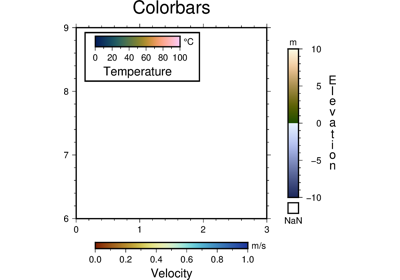
Figure.colorbar(**kwargs)¶ Plot a gray or color scale-bar on maps.
Both horizontal and vertical scales are supported. For CPTs with gradational colors (i.e., the lower and upper boundary of an interval have different colors) we will interpolate to give a continuous scale. Variations in intensity due to shading/illumination may be displayed by setting the option -I. Colors may be spaced according to a linear scale, all be equal size, or by providing a file with individual tile widths.
Full option list at https://docs.generic-mapping-tools.org/latest/colorbar.html
Aliases:
B = frame
C = cmap
D = position
F = box
G = truncate
J = projection
R = region
V = verbose
W = scale
X = xshift
Y = yshift
p = perspective
t = transparency
- Parameters
position (str) –
[g|j|J|n|x]refpoint[+wlength[/width]][+e[b|f][length]][+h|v]
[+jjustify][+m[a|c|l|u]][+n[txt]][+odx[/dy]]
. Defines the reference point on the map for the color scale using one of four coordinate systems: (1) Use g for map (user) coordinates, (2) use j or J for setting refpoint via a 2-char justification code that refers to the (invisible) map domain rectangle, (3) use n for normalized (0-1) coordinates, or (4) use x for plot coordinates (inches, cm, etc.). All but x requires both region and projection to be specified. Append +w followed by the length and width of the color bar. If width is not specified then it is set to 4% of the given length. Give a negative length to reverse the scale bar. Append +h to get a horizontal scale [Default is vertical (+v)]. By default, the anchor point on the scale is assumed to be the bottom left corner (BL), but this can be changed by appending +j followed by a 2-char justification code justify.box (bool or str) –
[+cclearances][+gfill][+i[[gap/]pen]][+p[pen]][+r[radius]]
[+s[[dx/dy/][shade]]]
. If set to True, draws a rectangular border around the color scale. Alternatively, specify a different pen with +ppen. Add +gfill to fill the scale panel [no fill]. Append +cclearance where clearance is either gap, xgap/ygap, or lgap/rgap/bgap/tgap where these items are uniform, separate in x- and y-direction, or individual side spacings between scale and border. Append +i to draw a secondary, inner border as well. We use a uniform gap between borders of 2p and the MAP_DEFAULTS_PEN unless other values are specified. Append +r to draw rounded rectangular borders instead, with a 6p corner radius. You can override this radius by appending another value. Finally, append +s to draw an offset background shaded region. Here, dx/dy indicates the shift relative to the foreground frame [4p/-4p] and shade sets the fill style to use for shading [gray50].truncate (list or str) –
zlo/zhiTruncate the incoming CPT so that the lowest and highest z-levels are to zlo and zhi. If one of these equal NaN then we leave that end of the CPT alone. The truncation takes place before the plotting.scale (float) – Multiply all z-values in the CPT by the provided scale. By default the CPT is used as is.
verbose (str) –
Select verbosity level [Default is w], which modulates the messages written to stderr. Choose among 7 levels of verbosity:
q - Quiet, not even fatal error messages are produced
e - Error messages only
w - Warnings [Default]
t - Timings (report runtimes for time-intensive algorthms);
i - Informational messages (same as “verbose=True”)
c - Compatibility warnings
d - Debugging messages
xshift (str) –
[a|c|f|r][xshift]. Shift plot origin in x-direction.yshift (str) –
[a|c|f|r][yshift]. Shift plot origin in y-direction. Full documentation is at https://docs.generic-mapping-tools.org/latest/gmt.html#xy-full.perspective (list or str) –
'[x|y|z]azim[/elev[/zlevel]][+wlon0/lat0[/z0]][+vx0/y0]'. Select perspective view and set the azimuth and elevation angle of the viewpoint. Default is [180, 90]. Full documentation is at https://docs.generic-mapping-tools.org/latest/gmt.html#perspective-full.transparency (float) – Set transparency level, in [0-100] percent range. Default is 0, i.e., opaque. Only visible when PDF or raster format output is selected. Only the PNG format selection adds a transparency layer in the image (for further processing).