Note
Click here to download the full example code
Coastlines and borders
Plotting coastlines and borders is handled by pygmt.Figure.coast.
Note
This tutorial assumes the use of a Python notebook, such as IPython or Jupyter Notebook.
To see the figures while using a Python script instead, use
fig.show(method="external) to display the figure in the default PDF viewer.
To save the figure, use fig.savefig("figname.pdf") where "figname.pdf"
is the desired name and file extension for the saved figure.
import pygmt
Shorelines
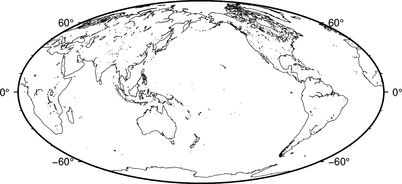
Use the shorelines argument to plot only the shorelines:
fig = pygmt.Figure()
fig.basemap(region="g", projection="W15c", frame=True)
fig.coast(shorelines=True)
fig.show()
Out:
<IPython.core.display.Image object>
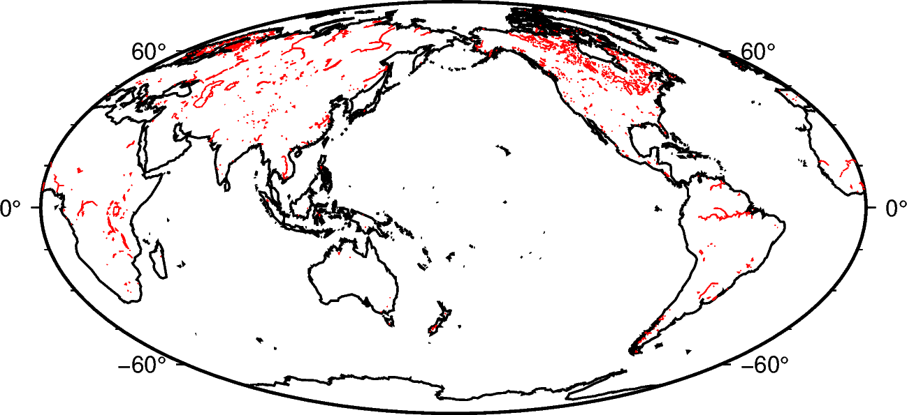
The shorelines are divided in 4 levels:
coastline
lakeshore
island-in-lake shore
lake-in-island-in-lake shore
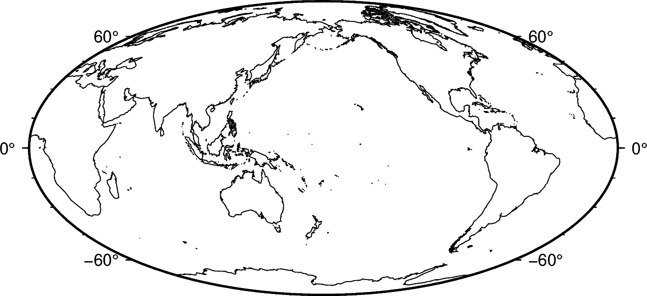
You can specify which level you want to plot by passing the level number and a GMT pen configuration. For example, to plot just the coastlines with 0.5 thickness and black lines:
fig = pygmt.Figure()
fig.basemap(region="g", projection="W15c", frame=True)
fig.coast(shorelines="1/0.5p,black")
fig.show()
Out:
<IPython.core.display.Image object>
You can specify multiple levels (with their own pens) by passing a list to
shorelines:
fig = pygmt.Figure()
fig.basemap(region="g", projection="W15c", frame=True)
fig.coast(shorelines=["1/1p,black", "2/0.5p,red"])
fig.show()
Out:
<IPython.core.display.Image object>
Resolutions
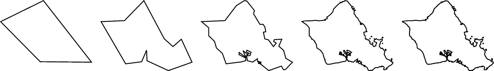
The coastline database comes with 5 resolutions. The resolution drops by 80% between levels:
"c": crude"l": low (default)"i": intermediate"h": high"f": full
oahu = [-158.3, -157.6, 21.2, 21.8]
fig = pygmt.Figure()
for res in ["c", "l", "i", "h", "f"]:
    fig.coast(resolution=res, shorelines="1p", region=oahu, projection="M5c")
    fig.shift_origin(xshift="5c")
fig.show()
Out:
<IPython.core.display.Image object>
Land and water
Use the land and water arguments to specify a fill color for land and water
bodies. The colors can be given by name or hex codes (like the ones used in HTML and
CSS):
fig = pygmt.Figure()
fig.basemap(region="g", projection="W10i", frame=True)
fig.coast(land="#666666", water="skyblue")
fig.show()
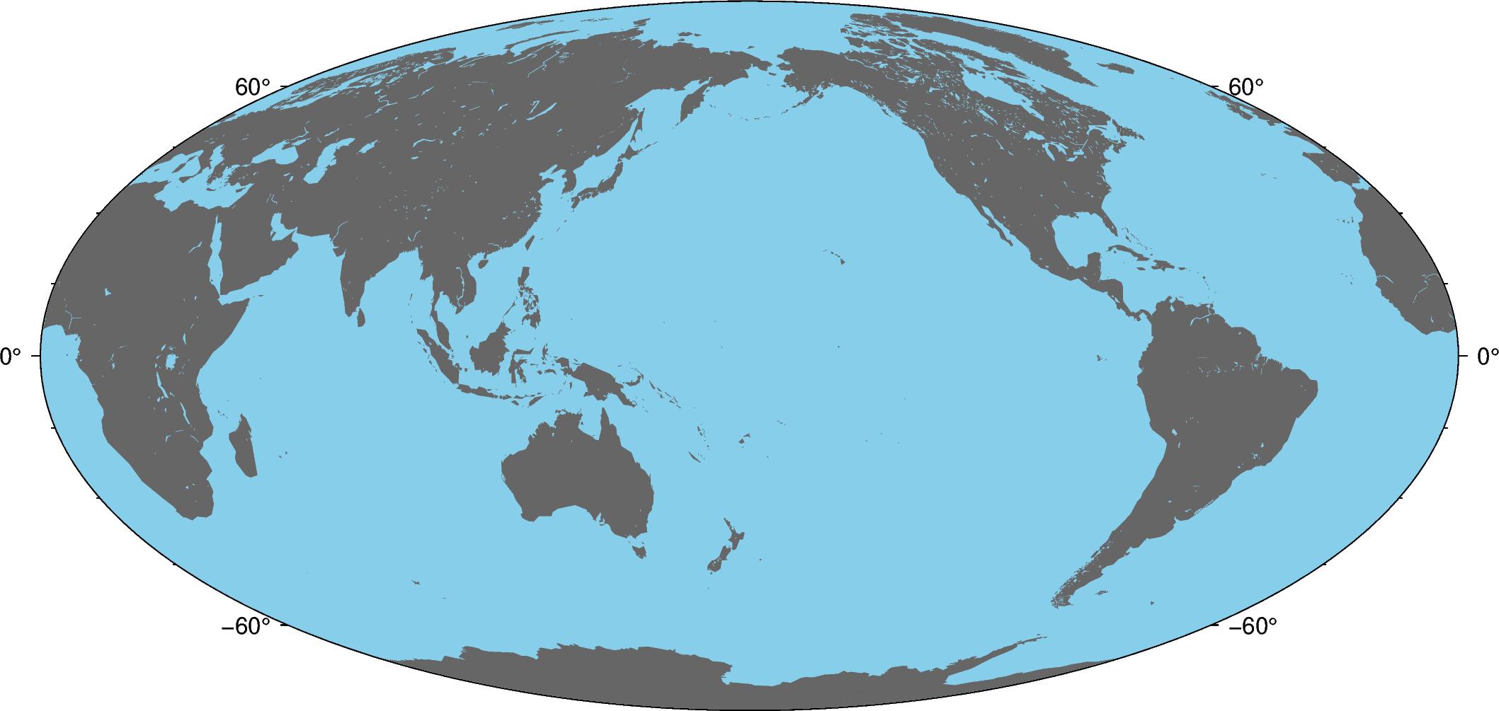
Out:
<IPython.core.display.Image object>
Total running time of the script: ( 0 minutes 8.579 seconds)