pygmt.Figure.plot3d
-
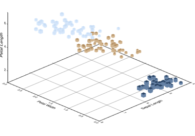
Figure.plot3d(x=None, y=None, z=None, data=None, sizes=None, direction=None, **kwargs)¶ Plot lines, polygons, and symbols in 3-D.
Takes a matrix, (x,y,z) triplets, or a file name as input and plots lines, polygons, or symbols at those locations in 3-D.
Must provide either
dataorx/y/z.If providing data through
x/y/z,colorcan be a 1d array that will be mapped to a colormap.If a symbol is selected and no symbol size given, then plot3d will interpret the fourth column of the input data as symbol size. Symbols whose size is <= 0 are skipped. If no symbols are specified then the symbol code (see
stylebelow) must be present as last column in the input. Ifstyleis not used, a line connecting the data points will be drawn instead. To explicitly close polygons, useclose. Select a fill withcolor. Ifcoloris set,penwill control whether the polygon outline is drawn or not. If a symbol is selected,colorandpendetermines the fill and outline/no outline, respectively.Full parameter list at https://docs.generic-mapping-tools.org/latest/plot3d.html
Aliases:
A = straight_line
B = frame
C = cmap
D = offset
G = color
I = intensity
J = projection
JZ = zsize
Jz = zscale
L = close
N = no_clip
Q = no_sort
R = region
S = style
V = verbose
W = pen
X = xshift
Y = yshift
Z = zvalue
c = panel
i = columns
l = label
p = perspective
t = transparency
- Parameters
x/y/z (float or 1d arrays) – The x, y, and z coordinates, or arrays of x, y and z coordinates of the data points
data (str or 2d array) – Either a data file name or a 2d numpy array with the tabular data. Use parameter
columnsto choose which columns are x, y, z, color, and size, respectively.sizes (1d array) – The sizes of the data points in units specified in
style. Only valid if usingx/y/z.direction (list of two 1d arrays) – If plotting vectors (using
style='V'orstyle='v'), then should be a list of two 1d arrays with the vector directions. These can be angle and length, azimuth and length, or x and y components, depending on the style options chosen.projection (str) – Required if this is the first plot command. projcode[projparams/]width. Select map projection.
zscale/zsize (float or str) – Set z-axis scaling or z-axis size.
region (str or list) – Required if this is the first plot command. xmin/xmax/ymin/ymax[+r][+uunit]. Specify the region of interest.
straight_line (bool or str) – [m|p|x|y]. By default, geographic line segments are drawn as great circle arcs. To draw them as straight lines, use
straight_line. Alternatively, add m to draw the line by first following a meridian, then a parallel. Or append p to start following a parallel, then a meridian. (This can be practical to draw a line along parallels, for example). For Cartesian data, points are simply connected, unless you append x or y to draw stair-case curves that whose first move is along x or y, respectively. Note: Thestraight_lineparameter requires constant z-coordinates.frame (bool or str or list) – Set map boundary frame and axes attributes.
cmap (str) – File name of a CPT file or a series of comma-separated colors (e.g., color1,color2,color3) to build a linear continuous CPT from those colors automatically.
offset (str) – dx/dy[/dz]. Offset the plot symbol or line locations by the given amounts dx/dy[/dz] [Default is no offset].
color (str) – Select color or pattern for filling of symbols or polygons. Default is no fill.
intensity (float or bool) – Provide an intens value (nominally in the -1 to +1 range) to modulate the fill color by simulating illumination [Default is None]. If using
intensity=True, we will instead read intens from the first data column after the symbol parameters (if given).close (str) – [+b|d|D][+xl|r|x0][+yl|r|y0][+ppen]. Force closed polygons. Full documentation is at https://docs.generic-mapping-tools.org/latest/plot3d.html#l.
no_clip (bool or str) – [c|r]. Do NOT clip symbols that fall outside map border [Default plots points whose coordinates are strictly inside the map border only]. This parameter does not apply to lines and polygons which are always clipped to the map region. For periodic (360-longitude) maps we must plot all symbols twice in case they are clipped by the repeating boundary.
no_clip=Truewill turn off clipping and not plot repeating symbols. Useno_clip="r"to turn off clipping but retain the plotting of such repeating symbols, or useno_clip="c"to retain clipping but turn off plotting of repeating symbols.no_sort (bool) – Turn off the automatic sorting of items based on their distance from the viewer. The default is to sort the items so that items in the foreground are plotted after items in the background.
style (str) – Plot symbols. Full documentation is at https://docs.generic-mapping-tools.org/latest/plot3d.html#s.
Select verbosity level [Default is w], which modulates the messages written to stderr. Choose among 7 levels of verbosity:
q - Quiet, not even fatal error messages are produced
e - Error messages only
w - Warnings [Default]
t - Timings (report runtimes for time-intensive algorthms);
i - Informational messages (same as
verbose=True)c - Compatibility warnings
d - Debugging messages
pen (str) – Set pen attributes for lines or the outline of symbols.
xshift (str) – [a|c|f|r][xshift]. Shift plot origin in x-direction.
yshift (str) – [a|c|f|r][yshift]. Shift plot origin in y-direction. Full documentation is at https://docs.generic-mapping-tools.org/latest/gmt.html#xy-full.
zvalue (str) – value|file. Instead of specifying a symbol or polygon fill and outline color via
colorandpen, give both a value via zvalue and a color lookup table viacmap. Alternatively, give the name of a file with one z-value (read from the last column) for each polygon in the input data. To apply it to the fill color, usecolor='+z'. To apply it to the pen color, append +z topen.panel (bool or int or list) – [row,col|index]. Selects a specific subplot panel. Only allowed when in subplot mode. Use
panel=Trueto advance to the next panel in the selected order. Instead of row,col you may also give a scalar value index which depends on the order you set viaautolabelwhen the subplot was defined. Note: row, col, and index all start at 0.label (str) – Add a legend entry for the symbol or line being plotted.
perspective (list or str) – [x|y|z]azim[/elev[/zlevel]][+wlon0/lat0[/z0]][+vx0/y0]. Select perspective view and set the azimuth and elevation angle of the viewpoint. Default is [180, 90]. Full documentation is at https://docs.generic-mapping-tools.org/latest/gmt.html#perspective-full.
transparency (int or float) – Set transparency level, in [0-100] percent range. Default is 0, i.e., opaque. Only visible when PDF or raster format output is selected. Only the PNG format selection adds a transparency layer in the image (for further processing). transparency can also be a 1d array to set varying transparency for symbols.